
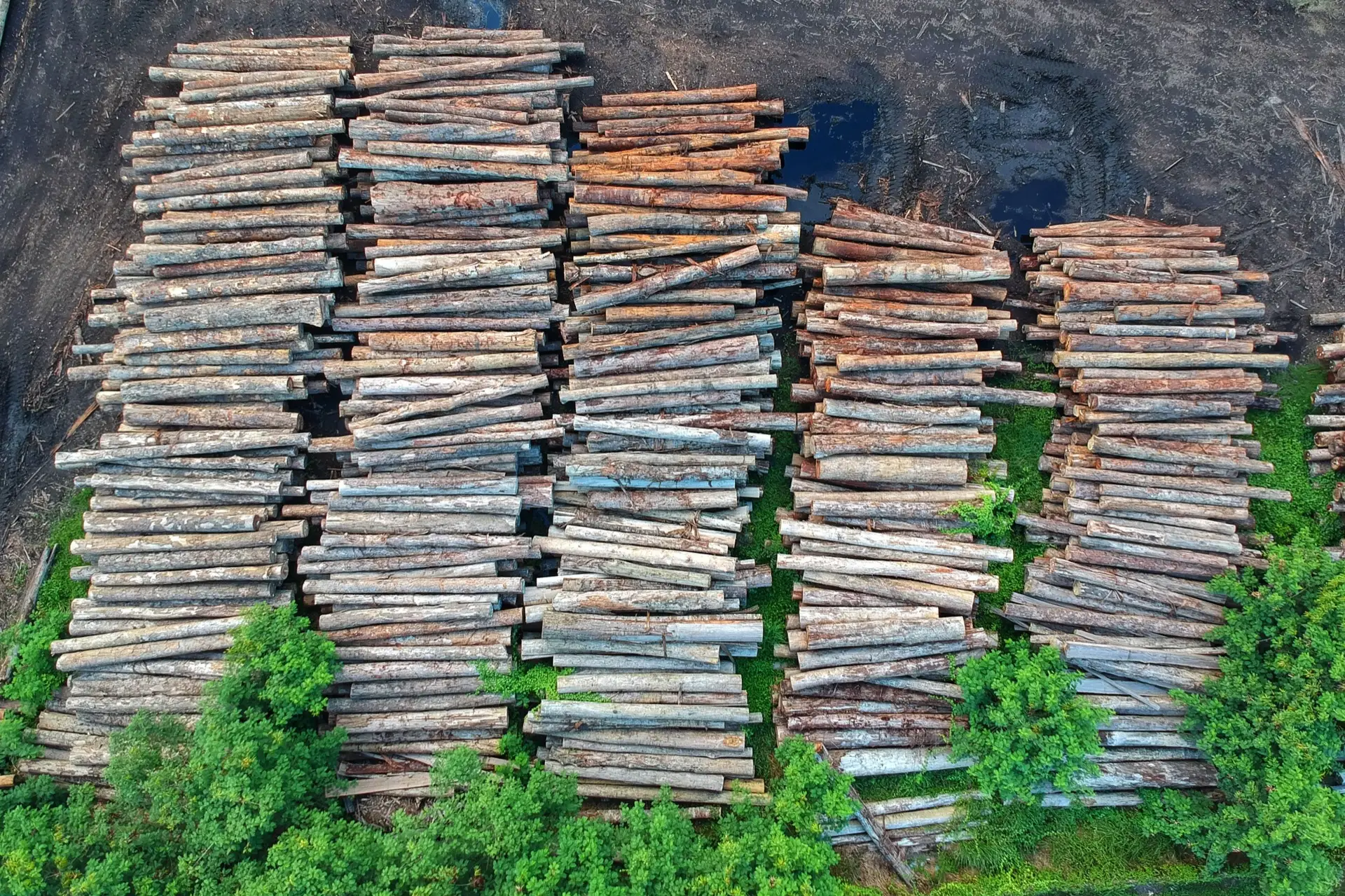
Satellite evidence for EUDR due diligence in southern Africa
The EU Deforestation Regulation asks a question about the past: was the land your timber came from forest that got cleared after 2020? Often the only record that can answer it is the satellite archive. This page explains how that evidence is built — and where it can mislead you if it's read carelessly.
EUDR compliance timeline and evidence
Dates, as of September 2026
Under the current EU text, due-diligence obligations apply from 30 December 2026 for large and medium operators and traders, and from 30 June 2027 for micro and small enterprises. Products must be free of deforestation occurring after 31 December 2020.
This timeline has already been postponed and amended more than once. Treat these dates as current as of September 2026 and confirm against the latest European Commission guidance before you rely on them.
What the regulation actually requires
Before a relevant product is placed on the EU market or exported from it, the operator has to hold the geolocation of the plots where it was produced — a polygon for plots over four hectares, a point for smaller ones — and be able to show that those plots were not deforested or degraded after 31 December 2020. For timber and charcoal, that means a defensible statement about land cover on each plot across a period that is already history, frequently on land the reporting company never managed.
You cannot fly a drone into 2020. The archive of open satellite imagery — Sentinel and Landsat, stretching back well before the cut-off — is often the only evidence that reaches back far enough to answer the question the regulation asks.
Why the country of origin changes the job
The EU grades every producing country as low, standard or high risk, and the grade sets how much due diligence an operator must do.
South Africa, Eswatini and Lesotho are graded low risk. Operators still have to collect plot geolocation and supporting information, but a formal risk assessment is not required unless there is a risk of mixing with, or circumvention through, other origins.
Mozambique, Zimbabwe, Zambia, Namibia, Botswana, Malawi, Tanzania and Angola are graded standard risk. Full due diligence applies, including a risk assessment that has to conclude the risk is negligible. That assessment is where plot-level satellite evidence carries the most weight.
The grade follows the country where the wood was grown, not the port it left from. Material that crosses a border in the region before shipping carries its origin with it.
When the free screening says “review”
Free screening tools now exist, built on the EU’s own 2020 forest cover map and on FAO’s open tools. Use them: for most plots they are enough.
They struggle where public maps disagree with each other — savanna and woodland, bush-thickened rangeland, plantation mosaics, and small plots at the edge of a 10 m pixel. Those plots come back flagged for review, and someone then has to make the call.
That call is the service. TerraX re-reads the flagged plot from the imagery archive and writes down the reasoning, so the decision in your due-diligence file rests on evidence rather than on whichever map happened to be consulted.
What plot-level evidence looks like in practice
It begins with the plot geometry: the actual boundary of each source plot, as a coordinate polygon where the plot size requires one. Against that geometry, the imagery archive is read to characterise land cover through time — forest, plantation, cleared ground — at and around the 2020 cut-off and onwards. The deliverable is a per-plot evidence record: the geometry, the land-cover trajectory, and the imagery basis for each conclusion, in a form that slots into a due-diligence file.
Establishing a pre-2021 baseline from the archive
The pivotal question is the state of each plot on 31 December 2020. That is reconstructed from imagery captured before the cut-off — building a baseline of what was standing then, against which everything after is compared. Because the archive is dense, the baseline is not a single cloudy scene but a considered read across the surrounding seasons.
Trap one: a harvest cycle is not a conversion
This is where remote sensing earns its fee, and where a naive reading does real damage. A commercial plantation on a normal rotation shows up in a time series as dramatic, repeated loss of canopy — because that is what harvesting looks like from orbit. It is not deforestation. Genuine deforestation is a change of land use: forest or plantation becoming something that is no longer forest and is not replanted.
Confuse the two and the evidence fails in both directions. Read a harvest as a conversion and you flag compliant timber as non-compliant. Wave through a real conversion as "just a harvest" and you certify a breach. Telling them apart is a judgement about the pattern over time — cycle versus permanent change — and it is exactly the interpretation TerraX is accountable for.
There is a case between the two. For wood, converting natural or naturally regenerating forest into plantation after the cut-off counts as forest degradation, even though the land still carries trees. A time series has to be read for what replaced what, not only for whether canopy came back.
Trap two: was it forest at all?
The regulation defines forest by thresholds: more than half a hectare, trees taller than five metres, and canopy cover above ten percent, or trees able to reach those thresholds where they stand.
Across southern African savanna, bush-thickened rangeland often sits close to those lines. Whether a thinned block was forest on 31 December 2020 is a measurable question — canopy cover and height before the cut-off — not something to assert.
Measured carefully, it protects a legitimate product from being flagged. It also stops a genuine clearing being waved through as bush control.
Who this is for
- EU importers and operators sourcing wood or charcoal from southern Africa, particularly from standard-risk countries.
- Certification bodies and auditors who need an independent read on plots a screening tool has flagged.
- South African traders and processors handling material grown elsewhere in the region.
- Plantation companies that want harvest cycles documented as harvest cycles before someone reads them as loss.
Where this sits alongside FSC and PEFC
Satellite evidence does not replace chain-of-custody certification. FSC and PEFC track the wood through the supply chain; the EUDR evidence layer establishes the land-use history of the plots the wood came from. They answer different questions and belong side by side in the same due-diligence file.
What TerraX does and does not certify
TerraX produces and signs the spatial evidence — plot geometry and land-cover history from the imagery. It does not issue an EUDR determination, guarantee acceptance by any competent authority, or replace your own due-diligence statement. The compliance decision, and its consequences, remain yours.
EUDR evidence — common questions
Does TerraX issue an EUDR compliance determination?
No. TerraX produces and signs the spatial evidence — plot geometry, the pre-2021 baseline, and the land-cover history that distinguishes harvest from conversion, with its uncertainty stated. The due-diligence determination, and its acceptance by a competent authority, remain the operator’s.
What is the EUDR deforestation cut-off date?
Under Regulation (EU) 2023/1115, products must be free of deforestation occurring after 31 December 2020. The application timeline has been amended more than once; confirm the current dates against the EU text before relying on them.
Can satellite imagery tell a routine harvest from deforestation?
Yes, but only from a time series, not a single image. A harvest cycle shows a sawtooth of canopy loss then recovery; a genuine conversion shows a step change with no forest return, usually replaced by a different land cover. Reading that correctly against a pre-2021 baseline is the core of the work.
What do you need from me to start?
The country of origin, your plot boundaries (or we build them from imagery), and whether a screening tool has already flagged any plots for review. From there we scope the evidence per plot.
Related insights
Preparing for the EUDR deadline?
Tell us the country of origin, roughly how many plots, whether you already hold plot boundaries, and whether a screening tool has flagged any for review. Reply within one working day.